Hiking and Exploring Squamish

Looking to get outdoors and explore Squamish? There are plenty of options for hikes of all levels, from the Sea to Summit trail to shorter trails with stunning views. No matter what your fitness level, there’s a hike for you. And what better way to explore than by getting up close and personal with nature by hiking and exploring Squamish? But of course, there’s way more to do in Squamish than just hiking! Keep reading below to find out more!

Jump to:

There are many benefits to hiking, including physical and mental health benefits. Hiking is a great option for those looking to get outdoors and explore. Hiking can help improve cardiovascular fitness, increase muscle strength, reduce stress levels, and improve mental well-being. Other than the health aspect, Squamish is one of the most scenic places in Canada, with quite a diverse range of activities you can do! Taking your time and hiking through it, is probably the best, and most accessible way to take it all in.

Be prepared to spend a whole day, or even a months, hiking and exploring Squamish. It is certainly a place you will long to return to, as there’s just so much!

The best hiking trails in Squamish

I had always found hiking to be one of my least favourite outdoor activities, to be quite honest. I found “walking” in the woods, to me, needed a bit more stimulation. (I know… there’s so much to unpack there…) But having found the mountains and frolicking in them for awhile, I have fell in love with this activity and gave me a renewed sense of being in the outdoors. It’s the perfect balance of being outdoors, taking in all the benefits of the polyphenols to de-stress, and exert as much or as little as I want it to be.

The Sea to Summit trail passes underneath this Sea to Summit Gondola, with views over Howe Sound

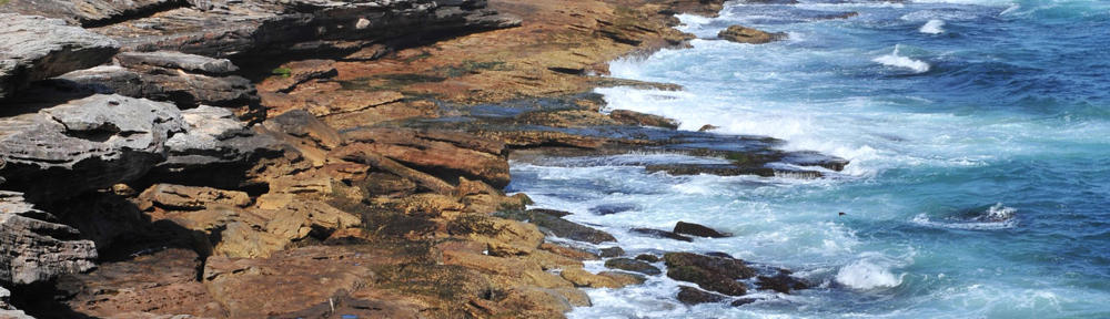
Getting to Squamish, the vistas over Howe Sound, the vertical, and being humbled in the mountains is something I long. No matter what your fitness level, there’s a hike for you in Squamish. While there are a lot of places to explore, here are 3 of the best hiking areas in Squamish to get you started. Check out each area for additional trails, details of how to descend, and trails maps among other information:

  • Sea to Summit Trail: This trail is a moderate to difficult hike that takes you from sea level to the summit of the Chief Mountain. The trail is 11 kilometres (6.8 miles) long and takes approximately 6 hours to complete.
  • Stawamus Chief Provincial Park: This park offers several different trails ranging from easy to difficult. Highlights include views of Howe Sound, the Stawamus Chief Mountain, and Shannon Falls.
  • Garibaldi Provincial Park: Garibaldi Provincial Park is home to many beautiful hikes, including the popular Black Tusk Trail. This moderate to difficult hike takes you through forests and meadows before reaching the stunning sub-alpine landscape around Black Tusk Lake.

Things to do in Squamish besides hike

Damian and Ian at the start of Skywalker (5.8)

This park is home to three granite peaks and offers amazing views of Howe Sound. So without a doubt, hiking is not the only thing you can do in Squamish. Below are some other activities to get your excited to exploring Squamish!

Rock Climbing: Of course, this is definitely an activity here and you may hire guides in the region to take you up some of these amazing faces. The Chief is where the climbs are at, but don’t forget Shannon Falls Provincial Park also carries a ton of climbs, including the classic and the infamous Skywalker (5.8).

Mountain biking: Given the region and the clout for outdoor adventures, Squamish hosts some of the best enduro riding. There are 5 main trail heads to access the trails. Alice Lake & Highlands, Diamond Head, Valleycliffe, and Brackendale. There are several operators in the region that will rent mountain bikes, if you’re not in a position to bring one of your own.

Kayaking Howe Sound: Squamish, situated right in the confluence of Howe Sound hosting the “Sea to Sky” corridor, you can definitely enjoy your paddling sports along with your vertical sports!

Cultural Attractions

Squamish and Lil’wat Cultural Centre: While not in Squamish proper, but in Whistler, this cultural centre is definitely worth a visit. Learn of First Nations that we reside on, on their unceded territory, their culture, and how we move forward in this epoque of reconciliation as nations to nation.

Brohm Lake Interpretive Forest: This forest is perfect for those who want to take a break from hiking and explore the area’s history and culture. The interpretive forest features several walking trails as well as an old growth forest and an abandoned logging town.

Britannia Mine Museum: Just south of Squamish by about 10 minutes, a family friendly museum hosts an award winning immersive multi-sensory live action story telling theatre, sharing the history of the mine and how the contributions to the community. There is also an interpretive tour through the old mines demonstrating how it worked in the mid 20th century.

An orca skeleton in the Britannia Mine Museum

Whether you’re looking for a challenging hike, a leisurely walk, or push yourself a bit more with some of the other activities, Squamish has something for everyone. Hiking and exploring Squamish is a great way to explore the area and get some exercise while you’re at it. So after exploring the history of the region, lace up your hiking boots, strap on your helmet, put on your life jacket, and let’er rip!

Backcountry Camping at McCrae Lake

With summer coming around the corner, paddling season is coming with it! Rob heads into the backcountry camping at McCrae Lake, in our video of backcountry camping at McCrae Lake. Our Explorations Team have all dabbled in said, once gate-kept area. Nestled amidst the untamed wilderness of Ontario lies the picturesque McCrae Lake, a haven for adventurers seeking respite from the chaos of modern life. As you embark on this journey into the heart of nature, let us be your guide, offering insights, tips, and recommendations to ensure a memorable and fulfilling backcountry camping experience at McCrae Lake. From the tranquil waters to the rugged terrain, McCrae Lake beckons, promising an adventure like no other.

Why McCrae Lake?

Backcountry camping in McCrae lake can be a very rewarding beginner-friendly places to go!

  • Untouched Beauty: The Canadian Shield terrain, complete with its ancient rocks and windswept pines, surrounds McCrae Lake. The landscape whispers stories of time immemorial, inviting you to connect with nature.
  • Campsites Galore: Approximately 50 campsites dot the shoreline, each with its unique charm. Some offer designated fire pits, while others allow for more rustic setups. Choose your spot, pitch your tent, and let the sounds of the forest lull you to sleep.
  • No Cottages, Just Solitude: Unlike much of Georgian Bay, McCrae Lake remains blissfully free of cottages. Here, it’s just you, the trees, and the shimmering water.
  • Backcountry Camping at McCrae lake: McCrae Lake is now a conservation reserve. This means it’s controlled by Ontario Parks and no permits or reservations are required. Just follow Leave No Trace principles, respect the wilderness, and immerse yourself in the raw beauty of the outdoors.

Discovering the Untamed Beauty of McCrae Lake:

Tucked away in the heart of Ontario’s wilderness, McCrae Lake awaits those with a spirit of exploration and a thirst for adventure. Surrounded by towering trees and crystal-clear waters, this pristine oasis offers a sanctuary for nature enthusiasts and outdoor aficionados alike. From hiking and fishing to swimming and stargazing, McCrae Lake boasts a wealth of activities to captivate the imagination and soothe the soul.

It once was a secluded unknown-to-many-lake, which over the course of time, attracted the likes of Torontonians. Putting in a flex here – over 15 years ago, on long weekends, you would only find maybe 5 cars parked. Now, parking overflows down the side of the cottage country roads, testament to the lake’s newfound popularity. More currently, during the pandemic, with everyone scrambling for outdoor space, McCrae Lake laid in the cross hairs of many.

Ian and Damian loaded up for a winter camping trip, in the parking lot of McCrae Lake, oh so many moons ago.

It’s proximity to Toronto draw weekend and long weekend-er crowds a like, given the accessibility to Toronto and the explosion in it’s popularity, many discover camping here! This is all good and well, we should recognize that backcountry camping at McCrae lake, precaution must still be taken. Bear-proof barrels, first aid kits, and emergency planning should still be in place.

Backcountry Camping at McCrae Lake

Despite the crowds, backcountry camping at McCrae Lake is still one of our favourite canoeing in Ontario areas to go to! Easy to find hiking trails, portages and even rock climbing. This includes winter camping! Please note, moderate knowledge of back-country camping is recommended.

Hiking Bliss

The trails at McCrae Lake are thoughtfully marked, inviting hikers to explore their secrets. The journey to the lookout point, aptly named Eagle’s Nest, can take up to 2 hours. But don’t stop there—continue along the trail, and you’ll be rewarded with the rugged beauty of the Canadian Shield that surrounds you, with quartz-stained granite rocks and windswept pines creating an otherworldly landscape. This is the epitome of backcountry camping at McCrae lake and in the boreal forest on the Canadian shield.

Paddling Paradise

For paddling enthusiasts, McCrae Lake offers a tranquil haven entry point for backcountry camping at McCrae Lake. There’s only 1 portage and is pretty well marked. You may be able to find it at night, but you’ll need a pretty powerful headlamp to find the reflective marking.

The relatively easy paddling conditions are perfect for beginners, but keep an eye on the winds—they can pick up, especially since you’re right off Georgian Bay. Glide across the water, soak in the serenity, and let the stresses of urban life melt away. As for firewood, be prepared to venture deep into the woods to find some deadwood, as most areas have been thoroughly picked clean by previous campers.

Rock Climbing Thrills

Ian pulling fancy heel hooks, working pitch 2 of a 5.10 climb at McCrae Lake

Calling all climbers! McCrae Lake’s granite faces offer challenges that will get your adrenaline pumping. Fixed anchors and bolts adorn the cliffs, inviting climbers to ascend. One standout climb takes you under a phenomenal roof—a challenging 5.12 rating. But fear not, there are routes for various skill levels, starting from 5.8 and climbing upwards. Traditional gear (trad gear) might be necessary for some routes, as not all are bolted. Keep an eye out for the occasional 2-pitch climbs, designed to break up the fall-zone considerations. Why not hoof in some gear while backcountry camping at McCrae lake and give it a shot?!

Gear Selection for Backcountry Camping at McCrae Lake

Preparing for your backcountry camping at McCrae Lake requires some thoughtful gear selection. Whether you’re hiking, paddling, or rock climbing, having the right equipment ensures safety, comfort, and an enjoyable experience. Check out our curated gear selection for your adventure!

Let’s dive into the essentials:

1. Hiking Gear

  • Footwear: Invest in sturdy hiking boots with good ankle support. The trails at McCrae Lake can be rugged, and proper footwear is crucial.
  • Backpack: Choose a comfortable daypack to carry essentials like water, snacks, a first aid kit, and extra layers.
  • Clothing: Dress in moisture-wicking layers to regulate body temperature. Don’t forget a waterproof jacket in case of rain.
  • Navigation: Bring a map, compass, or GPS device. While the trails are marked, it’s always wise to have backup navigation tools. The topographic map you’ll need is 31 D/13, Penetanguishene (1/50,000).
  • Headlamp: Essential for night hikes or emergencies.

2. Paddling Gear

  • Kayak or Canoe: If you’re paddling, rent or bring your own kayak or canoe. Ensure it’s in good condition.
  • Paddle: Lightweight and durable paddles are essential.
  • Personal Flotation Device (PFD): Always wear a PFD while on the water.
  • Dry Bag: Keep your belongings dry—especially your phone, wallet, and spare clothes.
  • Sun Protection: Sunglasses, a hat, and sunscreen are must-haves.

3. Rock Climbing Gear

  • Climbing Shoes: Invest in well-fitting climbing shoes with good grip.
  • Harness: A comfortable harness is essential for safety.
  • Helmet: Protect your head from falling rocks.
  • Chalk Bag: For a better grip on the rock.
  • Belay Device and Carabiners: If you’re climbing with a partner, these are crucial.
  • Trad Gear (if needed): Some routes may require traditional climbing gear (cams, nuts, slings).

4. Camping Essentials

  • Tent: Choose a lightweight, weather-resistant tent.
  • Sleeping Bag and Pad: Stay warm and comfortable during chilly nights.
  • Cooking Gear: A portable stove, cookware, and utensils.
  • Food and Water: Plan your meals and water filter.
  • Firestarter: Bring your own firestarter in case it’s too damp
  • Garbage bags: Leave No Trace! Respect the environment by packing out all trash.

5. Extras

  • Camera: Capture the stunning landscapes.
  • Swimsuit: Take a refreshing dip in the lake.
  • Multi-tool or Knife: Handy for various tasks.
  • Bug Repellent: Mosquitoes can be pesky.
  • Positive Attitude: The best gear won’t matter without a positive mindset!

Again, check out our curated page on gear selection! In case you’re wondering, or you prefer map and compass to navigate the back country, the topographic map you’ll need is 31 D/13, Penetanguishene (1/50,000).

Remember, McCrae Lake’s beauty lies in its untouched wilderness. Pack responsibly, leave no trace, and immerse yourself in the magic of this hidden gem. While a busy spot, backcountry camping at McCrae lake is definitely one that we are all fond of. Happy adventuring and check out the video, below, and enjoy!

Backcountry Camping at McCrae Lake video

Nashville Conservation

Another little gem I came across on finding places to hike around Toronto is the Nashville Conservation in Vaughan, under an hour from Toronto. Situated on the Humber River, the conservation seem to be taken over by the Toronto Regional Conservation Authority (TRCA) from, what appears to be, formerly Humber Valley Heritage Trail Association (HVHTA). There are several entrances to this park, but I chose, probably, the most popular one, as there were several cars.

There were maps around online I consulted. These two map, are the most comprehensive I’ve come to seeing. One provided by Humber Valley Heritage Trail Association (HVHTA) and the other from the trail head. However, after I started into the trail, it appears many of the trails are closed, at the time of writing (summer 2020), as TRCA is making changes.

As for the trail itself, as many of the trails were closed off with signs and barriers, we respected the signs and decided to not pursue. However, the trail does take you through forested and meadow areas, after crossing a beautiful old bridge, with tons of character. Apparently this bridge was last used in 1970’s and was abandoned. Read more on it here.

There’s not a lot of entrances to the Humber River, that I found, either sandbars or otherwise. However, there a lot of nice side trails that take you into more forested areas to wander and trample around. It would seem a section of it had be rehabilitated with predominantly pine trees, though, wish it were a better mix of various types of trees to increase ecosystem resilience

This is a very nice relaxing trail and I would suggest the Nashville Conservation would be suitable for a nice stroll with an old puppers. If you enjoyed Nashville Conservation, you like Greenwood Conservation!

And then there were mountains!

Ok guys, here’s the long awaited trek and climb in the Himalaya Lobuche Peak, in Nepal! There’s brief description of each day and will elaborate more in each section when there’s more to read.

Looking ahead to the summit, Himalaya Lobuche Peak

To-knows before reading:

  • AMS = Acute Mountain Sickness, also known as altituded sickness where the body tries to compensate for lack of atmosphere and oxygen to the brain
  • EBC = Everest Base Camp
  • All heights are calculated in meters. Multiply by 3 (roughly) for feet.

Where: Everest Mountain Range

Destination: Lobuche Peak (6,100) via Everest Base Camp (EBC – 5,600) and Kala Pattar (5,900), the Himalaya Lobuche Peak

Acclimatization process: 2 days in Namche Bazaar (3,200), 2 days in DingBuche (4,700). Acclimatization hike to EBC (5,600). Day rest. Acclimatization hike to Kala Pattar (5,900). Retreat to Lobuche Base Camp (4,900). Final height 6,100 meters at Lobuche Peak

Company:
Travel Ways Nepal – Things not included were gear rentals and emergency high altitude rescue insurance.

Support team:
 1 guide, 2 porters, 2 climbing guides. 2 Client total.

Number of days:
16 days on paper. 22 days total (Stuck 6 days in Lukla because of adverse weather)

Cost: ~
2,000 USD

Click the map to see what happened that day during the climb up. Not all events are documented in the map.
You may also click on the map and check out the links.
View Nepal Everest Base Camp and Lobuche Peak in a larger map

Streets of Thamel, Kathmandu

Day 1 – Meeting our guide Pema
Not that we’re in love with Thamel, but that’s where everything happens in Kathmandu. And it’s a pretty cool area.

We left Hasera with bittersweet good byes. Mito’s awesome food and Govinda’s uplifting spirit will be sorely missed. We head with Sujan, our volunteer coordinator who placed us there, to the taxi waiting for us that takes us back to Thamel.

Read more>>

Day 2 – Immigration visa extension
Pema picked us up at 10 am to head to the immigration office. Not a difficult procedure to get your visa’s extended. Just requires 30USD for 15 days, minimum and then 2USD for every additional day afterwards. We get back and Ian unpacked and re-packed the packs switching unnecessary stuff from India with needed stuff for mountaineering. Our hotel room is now a mass of boxes, back packs and half of our belongings from Korea.

Day 3 – Last minute scramble before departure
Epic scramble for last minute things! No time to write. Not much happened. Just a lot of running around. Plane ride in the morning.

Lukla runway

Day 4 – Let the suffering commence!
Ian looks out the cockpit window of the twin otter plane twin propeller plane. The runway is in full view of and covers the whole window. That usually doesn’t happen when you’re about to land. A huge “thunk” and jostle and the plane lands.

Read more>>

Day 5 – Trek
We wake up, pack, eat breakfast and set out for Namche Bazaar at 8 am. It was 3 hours away. This is also the first big altitude hike. Climbing from 2,700 meters to 3,400 (approx.) We didn’t know it could take 4 hours to climb 700 vertical meters.

Read more>>

Day 6 – Namche last minute gear purchases.
Nothing of significance. Stayed in Namche for acclimatization. Bought a few extra items for the up coming big trek. Resting for 5 hours of hiking on day 6. Namche marks the Alpine level where trees stop and rocks start becoming the common scene carved from the glaciers.

Namche Bazaar

Day 7 – Out of namche and onwards!
“1 more hour” Buba, one if the porters said. He said 1 hour an hour ago. We must be going really slow. Were at 3,900 meters and struggling through the clouds that have completely sucked any joy of being in the mountains. Each step is becoming more laboured. At 3,300 meters, the atmosphere provides 13% of oxygen, where as sea level is 21%. We’ve really reached above that level now.

Read more>> 

Day 8 – Dingbuche and more acclimatization.
A 4 hour hike that otherwise would’ve taken 2 hours. It seems like every time frame that’s given to us we should add 1.5 to it. These porters and guides not only carry a load of stuff, but they’re also pre-acclimatized to this altitude. We made it to 4,300 meters today.

Read more>>

Dingbuche Area

Day 9 – AMS and learning from it.
On the rest day in Dingbuche, Ian went for a bike for acclimatization while Christa rested her blistered feet. Ian climbed too high too fast and came back down with the worse AMS (acute mountain sickness) he’s felt yet.

Read more>> 

Day 10
Lobuche base camp and storm
Not the worst storm ever. But being at 4,900 meters make it seem a lot more real when thunder is going off beside you. The winds are starting to pickup.

Read more>> 

Everest Base Camp

Day 11 – Gorakshep and Everest Base Camp
We pack only a day pack to head up to Gorakshep which is the kick off point to head to Everest Base Camp. The packing took much longer than we expected as we are tired, frustrated and sick of AMS. The day was incredibly slow going. The altitude and AMS played such a huge role in making the trek really slow. Christa felt nausea got sick a few times. But she continued to be bad ass and headed the trek.

Read more>>

Day 12 – Kalla Pattar and back to Lobuche Base Camp
We jerked awake at 5am and tried to shut the alarm off. Then Pema came knocking at our door at 5:05. It was time to get up and climb Kalla Pattar. With bloodshot red eyes, we crawled out of bed. Ian went first to meet Pema. Christa was still in no good shape to tackle the mountain. At 5:30, departure time, she worked her boots on and coat on, like a boss.

Taking shelter at Lobuche Base Camp

Read more>>

Day 13 – Push for the summit
“Wake up Didi!” Won shouted. Didi meant sister in Sherpa. He shouted at Christa.

“We’re up! We’re up!” Ian responded back.

It got real the second time the alarm went off and our guides smacking and banging our tent. Christa cursed her AMS and Ian tore out of his sleeping bag… and then cursed his AMS.

Read more>>


Day 14 – 2nd attempt for the summit
“Wake up Didi!” Won shouted. Didi meant sister in Sherpa. He shouted at Christa.

“We’re up! We’re up!” Ian responded back. Well, second attempt for the summit. Hours earlier we had as gourmet of a feast as much as our AMS would allow. It’s funny, we’d thought we’d acclimatize faster. It’s been 4 days already living at 4,900 meters ASL and we’re still not fully acclimatized

Read more>>

Day 15 – Retreat to Dingbuche
After the longest approaching of our lives; 12 days hike, of which 4 days was for acclimatization, and 8 hours of actual approach to the top of Lobuche, we begin the journey downwards. For the past 5 days We lived at no less than 4,900 meters.

Victory Summit Salute! Himalaya Lobuche Peak

Read more>>

Day 15 – To Namche we go
After summiting Himalaya Lobuche Peak, we wake up to a very misty day. Rather, we were in the clouds. And its only called “fog” because we were standing on the ground, otherwise, it’s clouds.

We begin our death march back down. A grueling 9 hour day. With 2 major uphills that takes us back to altitude, or so it seems.

We get into Namche bazaar at 5 and just crash. That marks the longest day hike on this trip. Not counting the summit day.

Day 16 – Resting in Namche. Souvenir shopping!
Not much happened today as it was rest day. Our bodies still tired from the hike. No longer do we have the porters, we have to carry our own packs. 15-ish kgs isn’t so bad… for 3 hours. But for 9, it was painful. Christa blistered are getting worse as we have zero off days to let them heal completely. We can only tend them so much while not on the move.

We spend the day in namche bazaar shopping for 3 dollar gloves and 10 dollar shirts. Then caught a short movie based off Jon Krakauer’s book, Into Thin Air. Good thing Christa watched it after we went up the mountain….

We went to bed to prepare for a 6 hour hike to Lukla to get ready to fly out.

Our Porters

Day 17 – The great descent.
So remember day 15 as the longest hiking day? Scratch that one. Today we broke 11 hours of hiking straight. Summit day was still 13 hours of uphill/scramble/climb, so that still takes the gold. But today carrying the 15kg pack for 11 hours was probably the best feat we have done together.

At least we are in Lukla now. We’re resting for our flight back to Kathmandu. The weather has been pretty wild. Some days, no flights go out. We wake up tomorrow preparing to go down, but if not, were in Lukla for another day.

Some people have waited 10 days for the weather to clear out. Lets hope we catch our flight straight.

Namche Bazaar is really a Bazaar!

Day 18 – Stranded.
This was the first day to see if we can get a flight out. We woke up in the morning and not too soon after clouds rolled in. This was 8:30. No more roaring of engines landing in the field behind the lodge. We read, ate, and slept to pass the time.

Day 19 – Missed flight
Our actual departure day. The weather held out a bit, but they were letting all the backed up passengers go first. We missed our flight.

Sitting here now, at night listening to the rain hammer the tin roofs. Just last night the monastery held a party to commence the monsoon season. How fitting.

Day 20 – Waiting for breaks in weather

Finally getting off this mountain!

Still stuck. Raining now, and forecasted for the rest of the week. We pass our time reading books. So far, Game of Thrones has been winning. Had a legitimate chicken leg for the first time today. Real meat! Stumbled upon it by accident at the one restaurant we eat at. Making ourselves at home now. Watching tv at the bottom coffee shop. We own the channels. We’re no longer served food, instead we go look for the ladies that cook our food by wandering into their kitchen. People don’t take our orders. We go place them. Maybe tomorrow we’ll go wander out unto the rain and see if the airport is still there.

Day 21 – Considering helicopters at this point

Now we’re getting anxious. We still have to get back down to Kathmandu and pack for South Africa. We’re looking at different helicopter options and alternative route down, including hiking to another village and taking a bus. The only flights that are going are helicopters taking dead corpses off the mountain because of the storm hammering at higher altitudes.

Day 22 – Weather breaks! Finally out of Lukla!

Yes!! We’re out of here! The weather breaks! We’re pushed up in flights! Flying out!! 10 minute notice!  Scramble scramble scramble! This concludes the Himalaya Lobuche Peak trek and climb!

Our support team that brought us up, minus 1 climbing guide, Won